Design Better Extended: ArchHIVE proposes to revive the Manila Baywalk connection
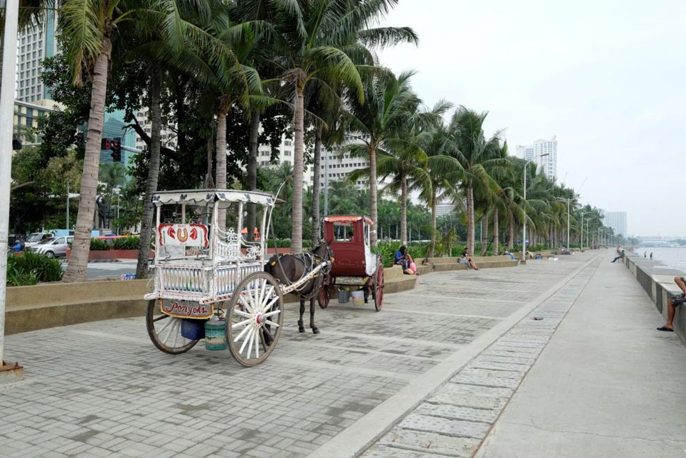
As the Philippines’ capital, Manila is home to many of government offices and historical landmarks , and a dense population. Poems have been written and songs sung about Manila Bay’s spectacular sunsets. Up until the 1980s, Manila Baywalk, a seaside promenade along Roxas Boulevard, was one of the most popular destinations in Metro Manila for sunset viewing. The baywalk is a two-kilometer pedestrian corridor that links the venerable Manila Hotel, historical Luneta Park, iconic Cultural Center of the Philippines, museums, government offices, exhibition and conference facilities, hotels, and restaurants.
With the “Buhayin ang Maynila” program of the early 2000s, the baywalk became a popular venue for open bars and restaurants. But after several years of operation, the establishments were ordered to move from the site for the violation of laws and the alleged promotion of prostitution. In 2011, a storm surge hammered the coastline of Manila Bay. Consequently, the pavement, the seawall, and breakwater were severely damaged and required another major renovation.
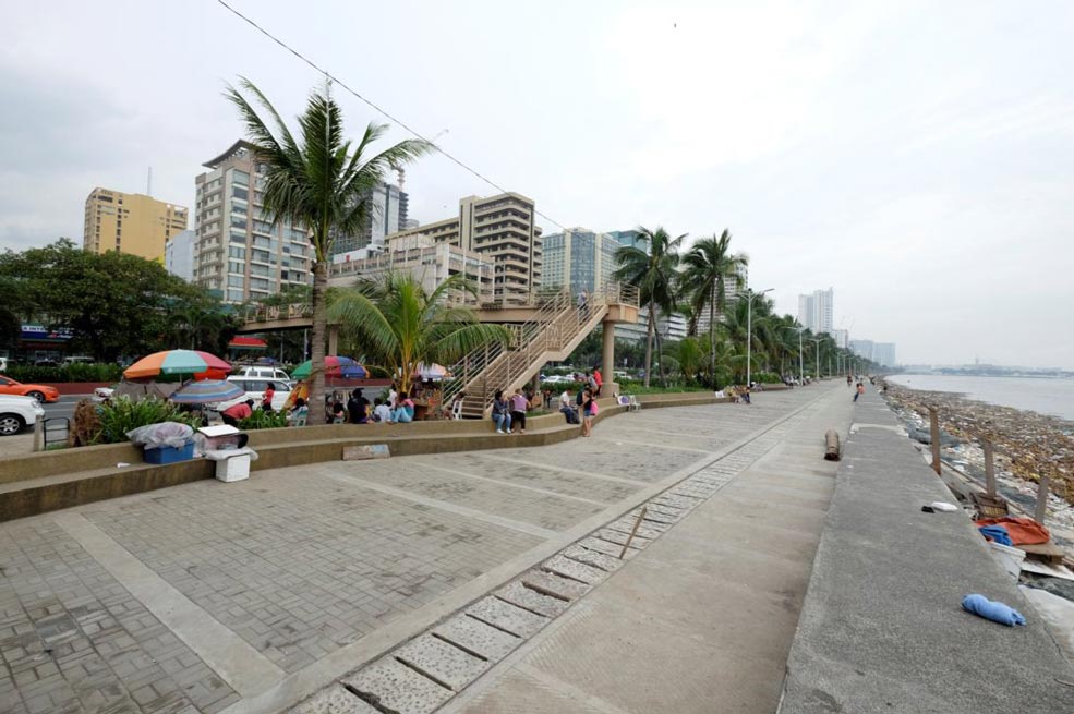
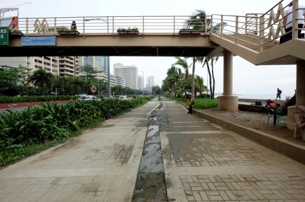
Today, the baywalk faces another problem: informal settlers and kiosks have sprouted. The Manila government claims limited financial capacity and, judging by the state of their public spaces, seems to pay little attention to the maintenance of such spaces.
Design Objectives
Rejuvenating Manila Baywalk would enhance local and foreign tourism, connect the community, and reinstate the site as a source of enjoyment and pride instead of disgust and shame. A redesign of the Manila Baywalk must be comprehensive to address the social, economic, and environmental issues of the waterfront promenade and end the problem-solution-problem cycle. ArchHIVE’s proposal aims to achieve the following:
- Promote the baywalk as a significant tourism corridor to other destinations of Manila by providing access to different transport modes.
- Accommodate profitable urban activities.
- Create an appealing, enjoyable, and storm-resilient waterfront.
Manila’s center line
We derive inspiration from the Quezon Memorial Circle, an existing urban park. Quezon Memorial, located at the center of the elliptical road in Quezon City, is accessible through different transport modes including the future MRT-7 line. It has been the venue for recreational activities in the city. 8,000 people go to Quezon Memorial Circle on weekdays and 12,000 on weekends. Recreational facilities and urban necessities were pl aced and have been generating 3 million pesos in monthly income. Rather than treating Manila Baywalk as an edge, the success of Quezon City Memorial Circle can be replicated at the waterfront so it can be maximized as “Manila’s Center Line” for recreation.
A comprehensive vision
Developing the waterfront cannot be done by a single solution. Realization must come into phases and gradual development. Each phase has its vision to realize, but, taken together, the steps will ensure long-term benefits.
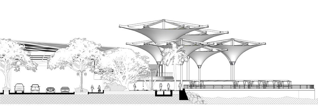
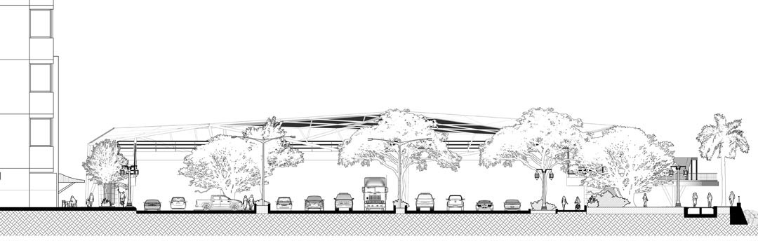
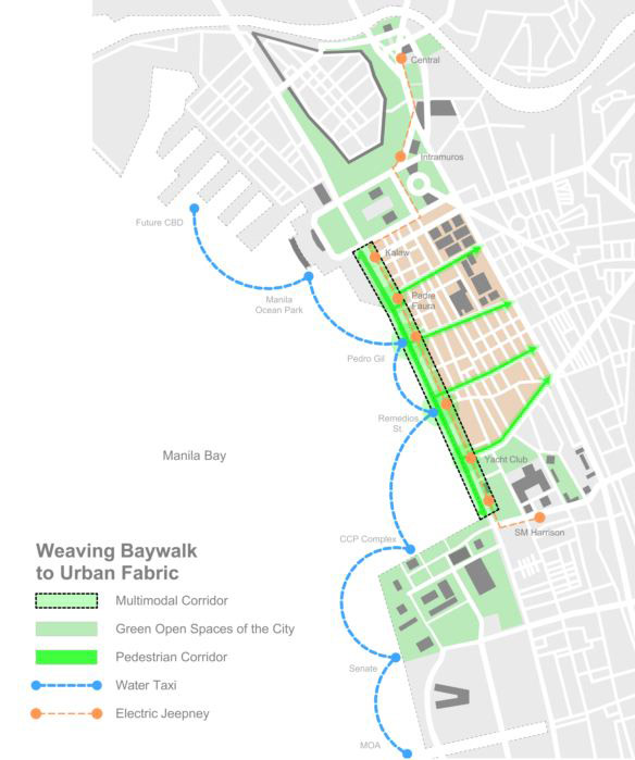
Vision 1: An intermodal transport Corridor
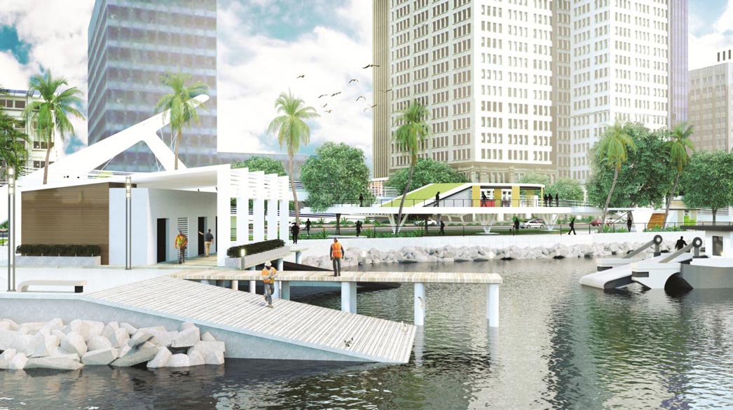
To bring it to its full potential, Manila Baywalk should first establish new connections. By providing new transport options and creating new nodes along its stretch, the baywalk will become more accessible. Transforming it into a multimodal corridor to significant places in Manila, the new Manila Baywalk will not only serve as Manila’s balcony overlooking sunset along its bay but also a passageway to iconic destinations in the city: the Mall of Asia Complex, the Cultural Center of the Philippines, Manila Ocean Park, and the future Manila CBD adjacent to Baseco Compound. Connecting them via water taxi will not only improve the mobility of people but will also offer a unique Manila Bay experience. A new electric jeepney route will also be available.
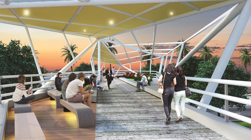
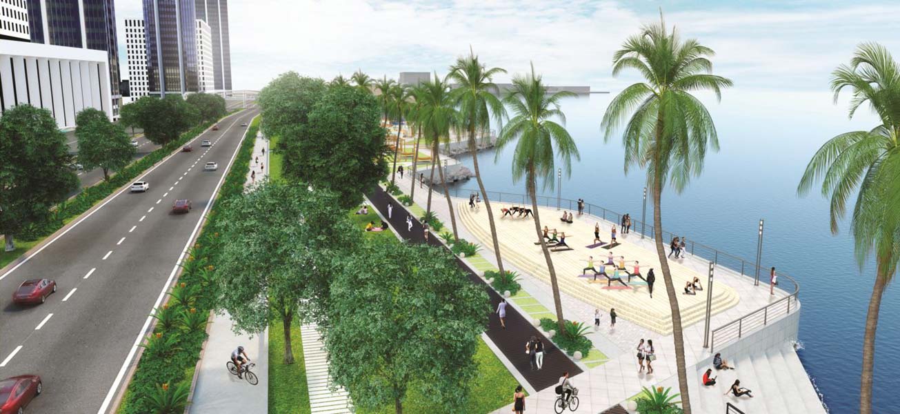
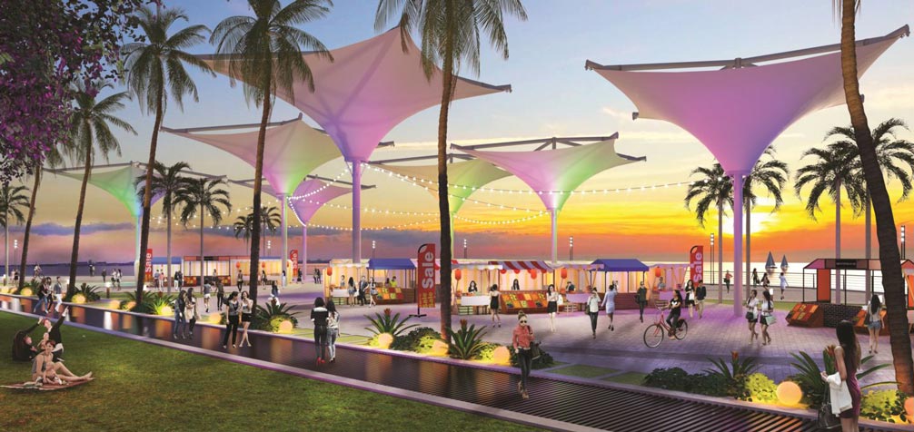
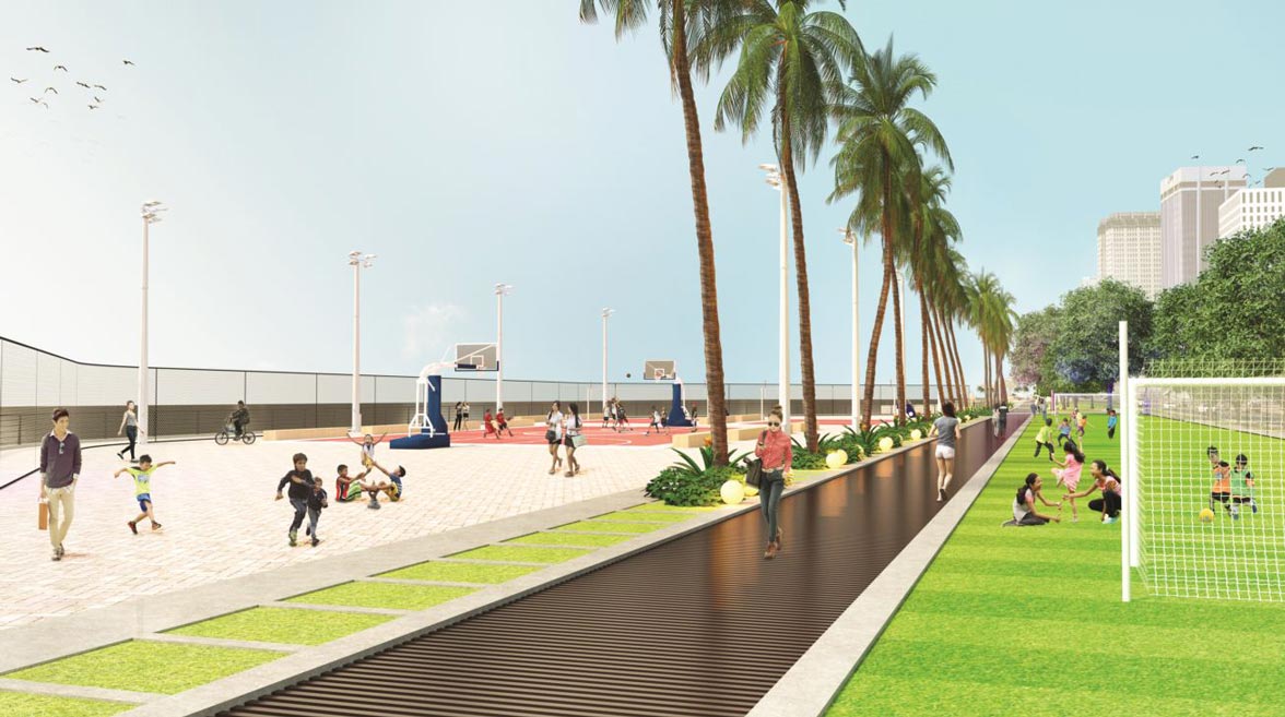
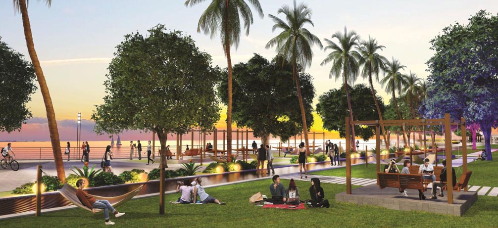
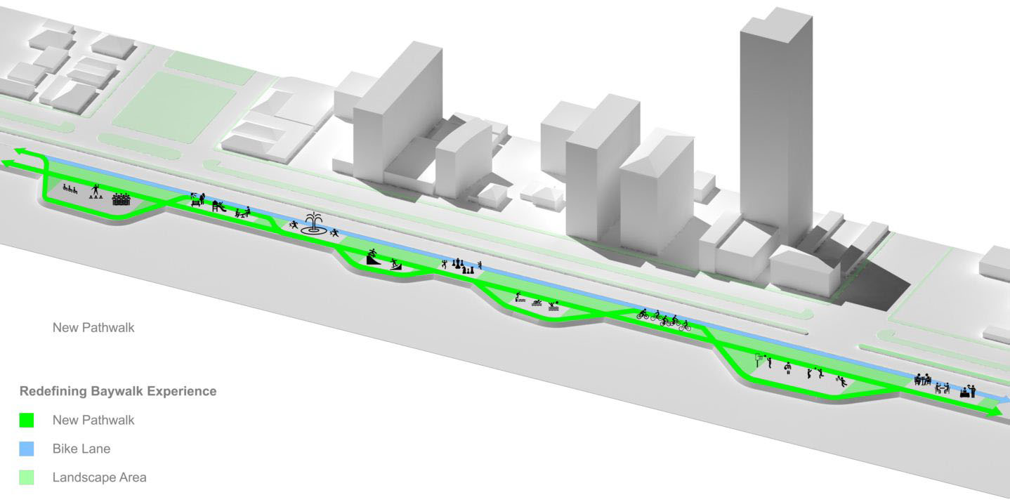
Vision 2: An engaging public space
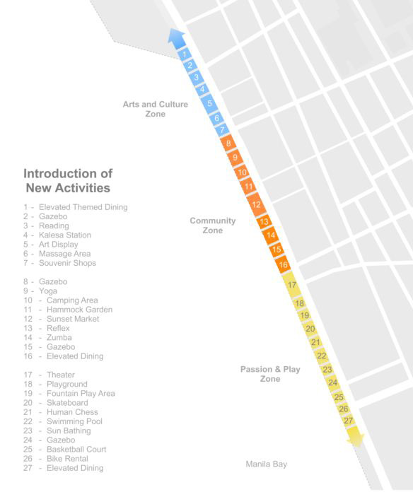
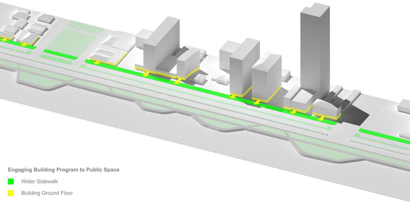
After the enhancement of waterfront connections to other destinations, Baywalk should establish a sustainable source of income for its operation and maintenance. It must redefine itself and change its focus from merely being Manila’s balcony for sunsets to an active space for the community. With this vision, the baywalk will host new urban amenities and activities. There will be defined spaces for promotions, gatherings, recreation, and other programs. Apart from this, the service road of Roxas Boulevard will be given wider sidewalks to become a promenade which will be beneficial to existing building programs like stores and restaurants.
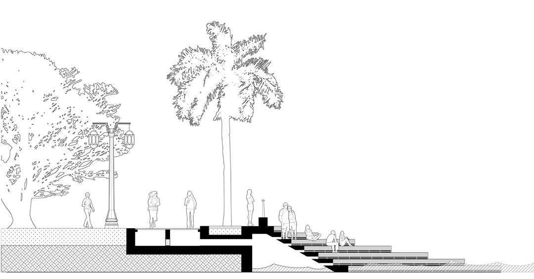
Vision 3: A resilient and sustainable waterfront
The new plan of Manila Baywalk is designed to disseminate the force of the extreme waves. The straight path walk will also serve as a wider drain for the overflows of Manila Bay – collecting the water faster and delivering it back to the sea. Solid wastes floating from the bay and the wastes from establishments will be collected and segregated at the provided material recovery facilities.
This proposal for the Manila Baywalk by ArchHIVE is an extension of BluPrint’s latest book venture called Design Better: 21 Proposals by 100 Designers to Provoke Discussion and Debate. The book is available in National Bookstore and Powerbooks.